Land surveying
For all your real estate projects, from boundary marking to certificates of location and more.
Services
For all your real estate projects, from boundary marking to certificates of location and more.
For your road, building, civil engineering, or other complex and precision construction projects.

Land surveying is used to establish the boundaries of your property, describe the buildings on it, and plan what you will do with them.
Subdivision and expertise in real estate development
Subdivision is the operation by which lots are created. Whether it’s to densify residential areas by splitting existing lots or to develop a new neighbourhood, land surveyors ensure that subdivision standards and constraints are followed while maximizing the potential of each site.
GPLC has built a solid reputation in this field and will help see your project through.
Horizontal and vertical cadastral registration (for co-owned properties)
Unlike classic subdivision, these cadastral operations aim to delineate the private portions of co-owned properties that require declarations of co-ownership.
Proposed siting plans and siting certificates
These two documents usually go together!
A proposed siting plan is a must when applying for a new construction permit. At a glance, it shows all the constraints on a lot (easements, waterways, wetlands, flood zones, steep slopes, areas at risk of landslides, etc.) and locates the future structure or building in relation to the property lines, ensuring everything is compliant with municipal siting standards.
The siting certificate is issued once physical markers (usually iron stakes) have been placed on the property to indicate precisely where the structure or building is to be located.
A certificate of location is also required at the end of the project in order to prove that the new structure or building complies with municipal by-laws.
Measurement certificates (BOMA)
The purpose of the BOMA measurement certificate is to ensure that the common areas of an office building, shopping centre, or industrial building are equitably distributed among all tenants.
Whether you’re looking to set up this measurement method for your building or calculate the surface area you’re occupying, we can help.
Topographic and location plans
These plans are used to locate buildings, structures, or physical features in relation to property lines or to provide their elevations in an established coordinate system.
They are particularly useful when planning new construction.
Description by metes and bounds
This document is generally used to describe a portion of a lot that will be subject to an easement or transaction. It is often used for subdivisions or to sell part of a lot.
Boundary marking
Boundary marking is used to establish a permanent and irrevocable property line. It is the go-to solution when neighbours disagree on shared property lines.
Unless the parties decide otherwise from the get-go, the procedure must follow the Civil Code of Québec and the Code of Civil Procedure.
As needed, the boundary marking can be amicable (no formalities), judicial, or extrajudicial.
Staking
Staking is the process of placing survey markers along the boundaries of a property. It is usually done during subdivision projects to make lots easier to develop.
Staking is best when there are no conflicts with neighbours regarding the position of the property lines; otherwise, boundary marking is the best solution.
Certificates of location
In this document, the land surveyor gives their opinion on whether the occupation of the premises, the property titles, and the cadastral plans of a building all match.
They also comment on the compliance of the buildings and structures on the site with applicable laws and regulations.
Certificates of location allow purchasers and their mortgagees to have accurate information in this regard.
From there stem a wide variety of operations.
All buildings (houses, factories, hospitals, etc.) must be built in the right place—they have to follow the legislation on sizes and locations.
Land surveyors know these concepts like the back of their hands and can give you the support you need for your project.

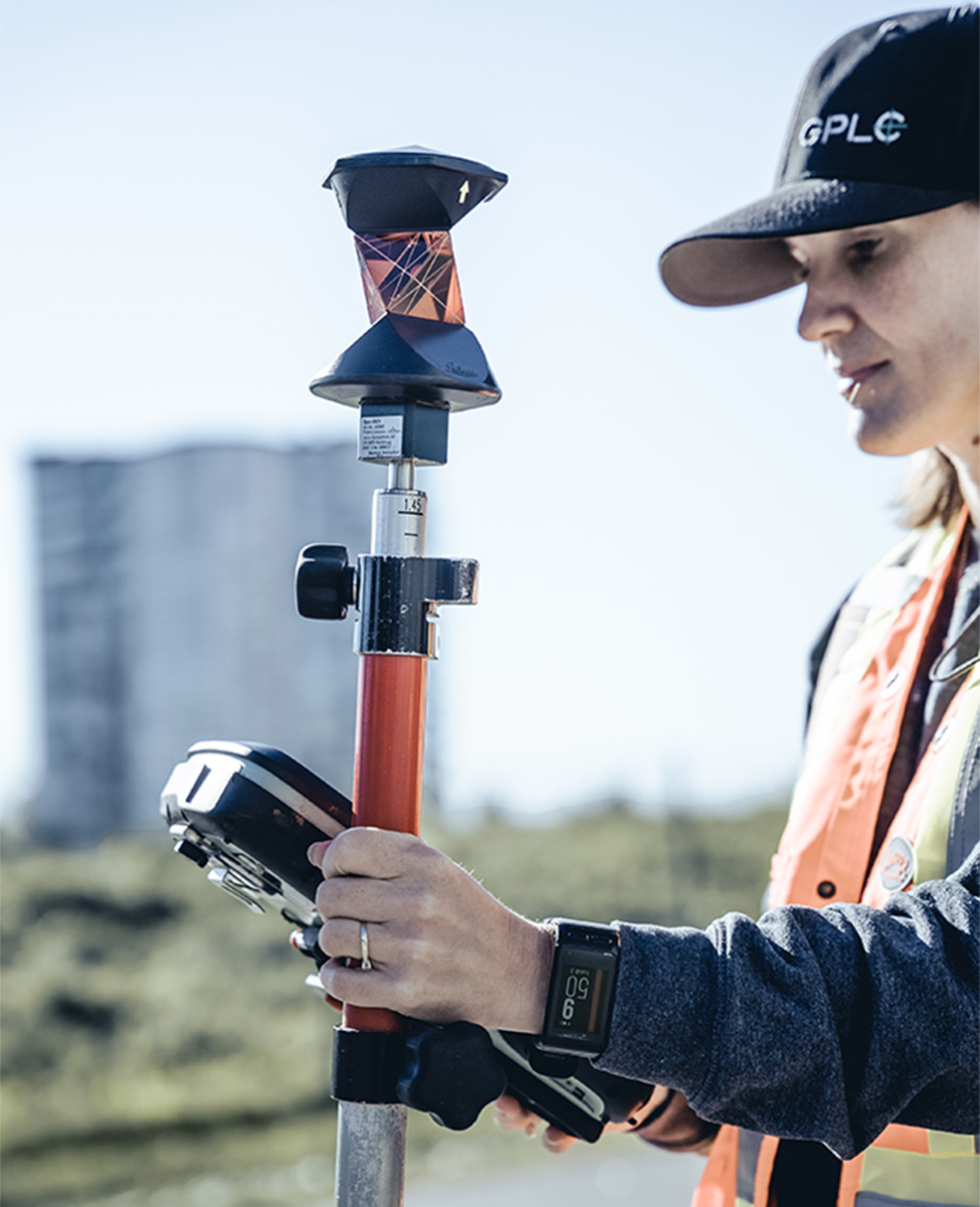
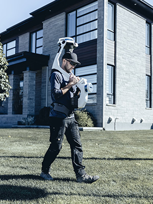
This automated tool allows a single technician to perform a variety of location and siting operations.
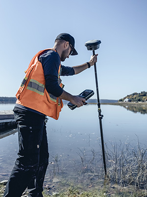
This technology draws on the GPS, GLONASS, Galileo, and BeiDou constellations to identify locations accurately and universally.
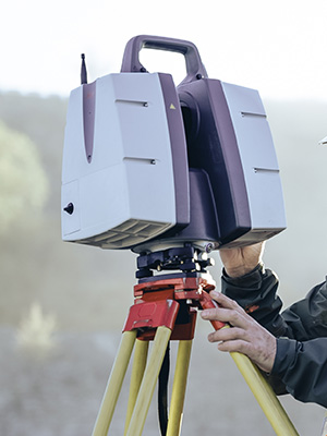
Capable of capturing an impressive number of points quickly and accurately, this technology can be used on even the largest of projects.
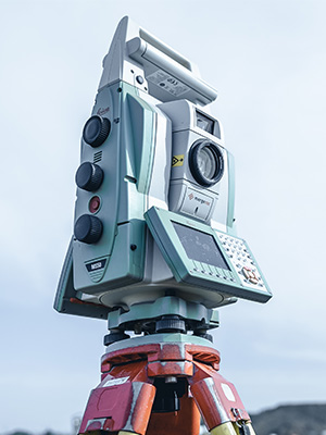
This highly versatile instrument is designed primarily for indoor spaces. It automates several operations and speeds up data collection.
Let our achievements prove that we’re the right partner for you.